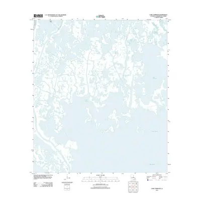
2012 Map of Lake Tambour
USGS Topo · Published 2012About this map
Bayou Terrebonne and Bayou Petit Caillou snake through the fragile coastal wetlands of Terrebonne Parish in this 2012 topographic record. The landscape is a complex aquatic network where the distinction between land and water is increasingly fluid, centered on the broad reaches of Lake Tambour and Lake Barre. This map captures the intricate hydrology of the Louisiana coast just after the turn of the twenty-first century, showing man-made interventions like the Bush Canal alongside ancient natural waterways such as Grand Bayou Bourbeux and Bayou l'Ourse. The map is characterized by a high density of named bayous including Bayou Barbue, Bayou Chitigue, and Bayou Jack, reflecting a region where every waterway serves as a vital artery for navigation and local history.
Find a feature on this map
22 named features on this map. Tap any name to fly to it.
Don’t see what you’re looking for? This feature index may not catch every label — zoom into the map to look around manually.
Map Details
Editions of this 2012 Lake Tambour Map
This is the sole edition of this map. No revisions or reprints were ever made.
Other maps of this area

1894 · Timbalier
USGS Topo · 1:62,500

1894 · Lake Felicity
USGS Topo · 1:62,500

1894 · Dulac
USGS Topo · 1:62,500

1935 · Cocodrie
USGS Topo · 1:31,680

1935 · Bourbeux
USGS Topo · 1:31,680

1935 · Viguerie Canal
USGS Topo · 1:31,680

1935 · Montegut
USGS Topo · 1:31,680

1935 · Lake Quitman
USGS Topo · 1:31,680

1935 · Lake Gero
USGS Topo · 1:31,680

1939 · Lake Felicity
USGS Topo · 1:62,500