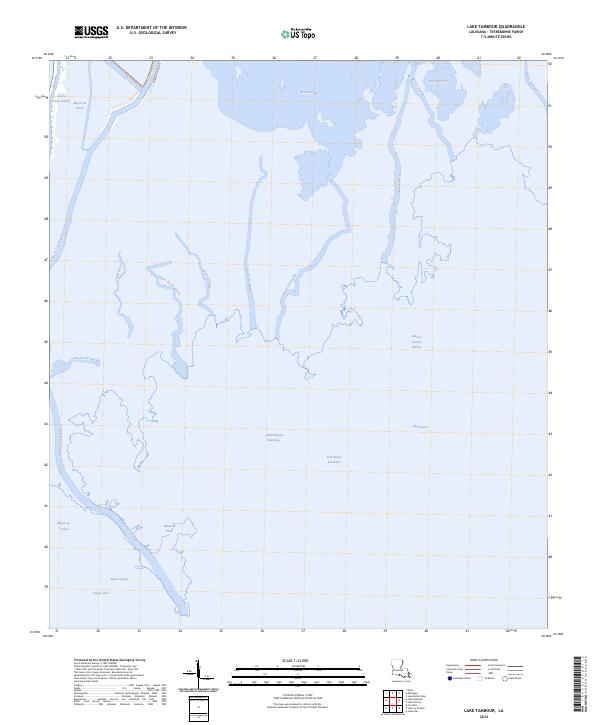
2024 Map of Lake Tambour
USGS Topo · Published 2024About this map
The deltaic landscape of Terrebonne Parish is defined by an intricate web of waterways and marshlands, where the land fragmentizes into countless peninsulas and islands. Madison Bay and Bay Baptiste dominate the northern reaches, while the transition between open water and wetland is marked by long-standing bayous that have historically guided settlement and transport in this region. The primary infrastructure is concentrated along the western edge, following the course of Bayou Petit Caillou and Bayou Terrebonne, where traditional land divisions are still visible in the property boundaries. Inland, the map reveals the complex drainage network formed by Grand Bayou Bourbeux and Petit Bayou Bourbeux. Aside from Madison Canal Rd and the Bush Canal, the area remains largely dominated by its natural hydrography, including named reaches such as Bayou Charles Theriot and Bayou Jack.
Find a feature on this map
28 named features on this map. Tap any name to fly to it.
Don’t see what you’re looking for? This feature index may not catch every label — zoom into the map to look around manually.
Map Details
Editions of this 2024 Lake Tambour Map
This is the sole edition of this map. No revisions or reprints were ever made.
Other maps of this area

1894 · Timbalier
USGS Topo · 1:62,500

1894 · Lake Felicity
USGS Topo · 1:62,500

1894 · Dulac
USGS Topo · 1:62,500

1935 · Cocodrie
USGS Topo · 1:31,680

1935 · Bourbeux
USGS Topo · 1:31,680

1935 · Viguerie Canal
USGS Topo · 1:31,680

1935 · Montegut
USGS Topo · 1:31,680

1935 · Lake Quitman
USGS Topo · 1:31,680

1935 · Lake Gero
USGS Topo · 1:31,680

1939 · Lake Felicity
USGS Topo · 1:62,500