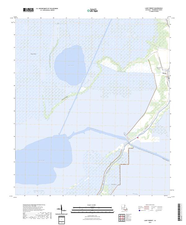
2024 Map of Lake Theriot
USGS Topo · Published 2024About this map
The settlement of Theriot occupies a distinct ridge of higher ground in the Terrebonne Parish wetlands, where the community is anchored by the Saint Eloi church and an adjacent Cem. This landscape is defined by the complex transition between open water and marshland, dominated by the circular expanse of Lake Theriot and the sprawling Lake De Cade to the south. Historically significant waterways like Bayou du Large and Bayou Mauvais Bois illustrate the traditional drainage and transit patterns of the delta, while modern engineering is evident in the straight lines of the Minors Canal and Marmande Canal. The local infrastructure is oriented along the natural levees, with Bayou du Large Rd following the water's edge. Features such as Marmande Ridge and Congo Island provide structural variety to the marsh, while the Marmande Airport serves as a remote outpost for aerial access to this water-bound region.
Find a feature on this map
27 named features on this map. Tap any name to fly to it.
Don’t see what you’re looking for? This feature index may not catch every label — zoom into the map to look around manually.
Map Details
Editions of this 2024 Lake Theriot Map
This is the sole edition of this map. No revisions or reprints were ever made.
Other maps of this area

1892 · Gibson
USGS Topo · 1:62,500

1892 · Houma
USGS Topo · 1:62,500

1894 · Bayou De Large
USGS Topo · 1:62,500

1894 · Dulac
USGS Topo · 1:62,500

1897 · Gibson
USGS Topo · 1:62,500

1932 · Houma SW
USGS Topo · 1:31,680

1935 · Theriot
USGS Topo · 1:31,680

1935 · Lake Mechant
USGS Topo · 1:31,680

1935 · Lake Quitman
USGS Topo · 1:31,680

1935 · Lake Gero
USGS Topo · 1:31,680