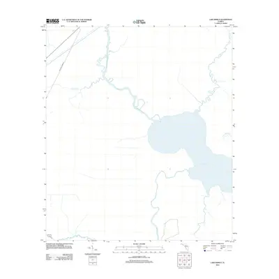
2012 Map of Lake Wimico
USGS Topo · Published 2012About this map
Lake Wimico dominates this coastal landscape, serving as a central hydrological feature within Gulf County. The area is defined by a complex network of freshwater and brackish channels, including Searcy Cr and Horseshoe Cr, which weave through the low-lying terrain to meet the Intracoastal Waterway. The presence of the Old Niles Tramroad in the northwest provides a window into the region's industrial past, likely representing a former logging or transport corridor through the wetlands.
Find a feature on this map
8 named features on this map. Tap any name to fly to it.
Don’t see what you’re looking for? This feature index may not catch every label — zoom into the map to look around manually.
Map Details
Editions of this 2012 Lake Wimico Map
This is the sole edition of this map. No revisions or reprints were ever made.
Other maps of this area

1943 · Port St. Joe
USGS Topo · 1:31,680

1943 · Cape San Blas
USGS Topo · 1:31,680

1943 · West Pass
USGS Topo · 1:31,680

1943 · Overstreet
USGS Topo · 1:31,680

1943 · Indian Pass
USGS Topo · 1:24,000

1943 · Jackson River
USGS Topo · 1:24,000

1944 · White City
USGS Topo · 1:24,000

1944 · Forbes Island
USGS Topo · 1:24,000

1945 · Forbes Island
USGS Topo · 1:31,680

1945 · Lake Wimico
USGS Topo · 1:31,680