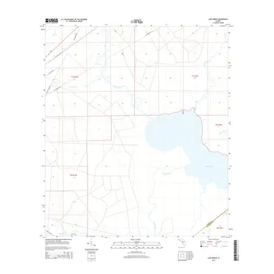
2015 Map of Lake Wimico
USGS Topo · Published 2015About this map
Lake Wimico and its extensive network of drainages dominate this Gulf County landscape, where the freshwater systems of the Florida Panhandle meet the coastal wetlands. The map documents a complex history of industrial land use, notably the legacy of the timber industry as evidenced by the presence of the Old Niles Tramroad and Old Niles Tram Rd, which once facilitated movement through these low-lying areas. Numerous water bodies including Searcy Creek, Horseshoe Cr, and Depot Creek meander through the terrain, illustrating the hydrologic character of the region. Transportation infrastructure is represented by Sr-71 and various access routes like Freshwater Canal Rd and Old Logging Rd. The boundary between Gulf County and Franklin County is visible in the southeastern corner, marking the shift in local jurisdictions across this watery environment.
Find a feature on this map
21 named features on this map. Tap any name to fly to it.
Don’t see what you’re looking for? This feature index may not catch every label — zoom into the map to look around manually.
Map Details
Editions of this 2015 Lake Wimico Map
This is the sole edition of this map. No revisions or reprints were ever made.
Other maps of this area

1943 · Port St. Joe
USGS Topo · 1:31,680

1943 · Cape San Blas
USGS Topo · 1:31,680

1943 · West Pass
USGS Topo · 1:31,680

1943 · Overstreet
USGS Topo · 1:31,680

1943 · Indian Pass
USGS Topo · 1:24,000

1943 · Jackson River
USGS Topo · 1:24,000

1944 · White City
USGS Topo · 1:24,000

1944 · Forbes Island
USGS Topo · 1:24,000

1945 · Forbes Island
USGS Topo · 1:31,680

1945 · Lake Wimico
USGS Topo · 1:31,680