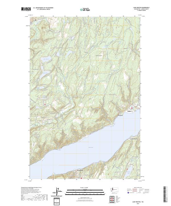
2023 Map of Lake Wooten
USGS Topo · Published 2023About this map
The Hood Canal defines the southern portion of this landscape, where waterfront communities like Sunbeach, Sunset Beach, and Forest Beach anchor the shoreline of the Great Peninsula. In the northern interior, a dense network of glacial lakes including Lake Wooten, Haven Lake, and Bennettsen Lake dot the forested terrain. This modern survey illustrates the contemporary road infrastructure connecting these seasonal and year-round residential pockets, such as NE Belfair Tahuya Rd, which links the larger settlement of Belfair to the river valleys of the west.
Find a feature on this map
89 named features on this map. Tap any name to fly to it.
Don’t see what you’re looking for? This feature index may not catch every label — zoom into the map to look around manually.
Map Details
Editions of this 2023 Lake Wooten Map
This is the sole edition of this map. No revisions or reprints were ever made.
Other maps of this area

1936 · Point Misery
USGS Topo · 1:62,500

1938 · Mt Constance
USGS Topo · 1:125,000

1938 · Allyn
USGS Topo · 1:62,500

1940 · Point Misery
USGS Topo · 1:62,500

1943 · Potlatch
USGS Topo · 1:62,500

1947 · The Brothers
USGS Topo · 1:62,500

1950 · The Brothers
USGS Topo · 1:62,500

1952 · Potlatch
USGS Topo · 1:62,500

1953 · Vaughn
USGS Topo · 1:24,000

1953 · Lake Wooten
USGS Topo · 1:24,000