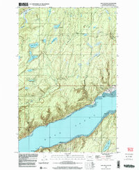
1999 Map of Lake Wooten
USGS Topo · Published 2003About this map
Hood Canal defines the southern reach of this landscape, where the waters meet the shorelines of Forest Beach and Shady Beach. The terrain is defined by a dense network of freshwater bodies, including Lake Wooten, Haven Lake, and Bennettsen Lake, suggesting a region shaped by glacial depressions and significant water resources. The Dewatto River and Tahuya River drain these uplands, creating a complex hydrologic system that supported both early infrastructure and recreation.
Find a feature on this map
37 named features on this map. Tap any name to fly to it.
Don’t see what you’re looking for? This feature index may not catch every label — zoom into the map to look around manually.
Map Details
Editions of this 1999 Lake Wooten Map
This is the sole edition of this map. No revisions or reprints were ever made.
Other maps of this area

1936 · Point Misery
USGS Topo · 1:62,500

1938 · Mt Constance
USGS Topo · 1:125,000

1938 · Allyn
USGS Topo · 1:62,500

1940 · Point Misery
USGS Topo · 1:62,500

1943 · Potlatch
USGS Topo · 1:62,500

1947 · The Brothers
USGS Topo · 1:62,500

1950 · The Brothers
USGS Topo · 1:62,500

1952 · Potlatch
USGS Topo · 1:62,500

1953 · Vaughn
USGS Topo · 1:24,000

1953 · Lake Wooten
USGS Topo · 1:24,000