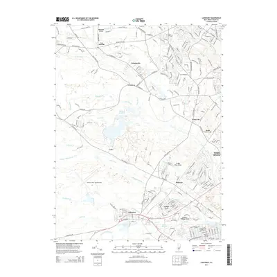
2014 Map of Lakehurst
USGS Topo · Published 2014About this map
The Lakehurst NAES / Maxfield Field aviation facility dominates the central landscape of this Ocean County study, surrounded by a complex network of residential developments and winding waterways. The borough of Lakehurst sits at the junction of RT-70 and RT-37, serving as a focal point near Horicon Lake and the Union Br. To the east, the rapid suburbanization of the region is evident in the sprawling layouts of Leisure Knoll, Leisure Village West, and Cedar Glen West, which contrast with the older, smaller settlements of Legler and Whitesville. The topography is defined by the low-lying Pinelands environment, where the Toms River and its numerous tributaries, such as Maple Root Br and Ridgeway Br, thread through the sandy coastal plain. This 2014 survey documents the dense interface between the military installation, protected wetlands, and modern residential expansion.
Find a feature on this map
39 named features on this map. Tap any name to fly to it.
Don’t see what you’re looking for? This feature index may not catch every label — zoom into the map to look around manually.
Map Details
Editions of this 2014 Lakehurst Map
This is the sole edition of this map. No revisions or reprints were ever made.
Other maps of this area

1884 · Whitings
USGS Topo · 1:62,500

1888 · Barnegat
USGS Topo · 1:62,500

1888 · Asbury Park
USGS Topo · 1:62,500

1888 · Cassville
USGS Topo · 1:62,500

1888 · Whitings
USGS Topo · 1:62,500

1893 · Asbury Park
USGS Topo · 1:62,500

1893 · Barnegat
USGS Topo · 1:62,500

1894 · Cassville
USGS Topo · 1:62,500

1898 · Barnegat
USGS Topo · 1:62,500

1900 · Cassville
USGS Topo · 1:62,500
Featured Places
- Toms River, NJ
- Lakewood Township, NJ
- Jackson Township, NJ
- Manchester Township, NJ
- Pine Lake Park, Manchester Township