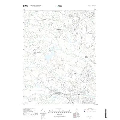
2019 Map of Lakehurst
USGS Topo · Published 2019About this map
The Lakehurst Naval Air Center and its adjacent Lakehurst Maxfield Field dominate the landscape southwest of the borough of Lakehurst. This modern survey illustrates the high density of residential developments and retirement communities that have come to define the area, including Leisure Village West, Leisure Knoll, and Pine Lake Park. Despite this growth, the map preserves the location of the Old Saint John's Church Cem, a key landmark for local genealogists. The intricate drainage network of the Pine Barrens is clearly visible, with numerous waterways like Ridgeway Branch, Manapaqua Br, and Old Hurricane Brook feeding into Horicon Lake. To the north, older settlements such as Holmansville and Van Hiseville are situated near the upper reaches of the Toms River, showing the transition from earlier crossroads villages to contemporary suburban patterns.
Find a feature on this map
40 named features on this map. Tap any name to fly to it.
Don’t see what you’re looking for? This feature index may not catch every label — zoom into the map to look around manually.
Map Details
Editions of this 2019 Lakehurst Map
This is the sole edition of this map. No revisions or reprints were ever made.
Other maps of this area

1884 · Whitings
USGS Topo · 1:62,500

1888 · Barnegat
USGS Topo · 1:62,500

1888 · Asbury Park
USGS Topo · 1:62,500

1888 · Cassville
USGS Topo · 1:62,500

1888 · Whitings
USGS Topo · 1:62,500

1893 · Asbury Park
USGS Topo · 1:62,500

1893 · Barnegat
USGS Topo · 1:62,500

1894 · Cassville
USGS Topo · 1:62,500

1898 · Barnegat
USGS Topo · 1:62,500

1900 · Cassville
USGS Topo · 1:62,500
Featured Places
- Toms River, NJ
- Lakewood Township, NJ
- Jackson Township, NJ
- Manchester Township, NJ
- Pine Lake Park, Manchester Township