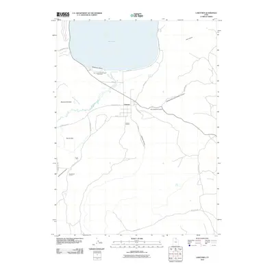
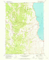
2010 Map of Laketown
USGS Topo · Published 2010About this map
Laketown sits at the southern edge of the high-altitude Bear Lake, serving as a central hub for the surrounding ranching and recreation landscapes in Rich County. The terrain transitions from the water's edge at Rendezvous Beach to the intricate drainage systems of Big Creek and Meadowville Creek. Local history is anchored in the valley floor at the Laketown Cemetery and the more remote Round Valley Cemetery situated near Cottonwood Canyon. The map reveals a network of canyons, such as Old Laketown Canyon and Pine Canyon, that define the eastward ascent toward higher ground. Settlement patterns follow the valley basins of Meadowville Valley and Round Valley, connected by rural routes like N Round Valley Dr and Strawberry Valley Rd. This survey reflects the modern balance between agricultural land use and the popular recreation areas found at the Bear Lake Rendezvous Beach Campground.
Find a feature on this map
31 named features on this map. Tap any name to fly to it.
Don’t see what you’re looking for? This feature index may not catch every label — zoom into the map to look around manually.
Map Details
Editions of this 2010 Laketown Map
This is the sole edition of this map. No revisions or reprints were ever made.
Other maps of this area

1912 · Randolph
USGS Topo · 1:125,000

1954 · Ogden
USGS Topo · 1:250,000

1958 · Ogden
USGS Topo · 1:250,000

1960 · Ogden
USGS Topo · 1:250,000

1968 · Randolph
USGS Topo · 1:24,000

1969 · Sheeppen Creek
USGS Topo · 1:24,000
1969 · Red Spur Mtn
USGS Topo · 1:24,000
1969 · Meadowville
USGS Topo · 1:24,000
1969 · Bear Lake South
USGS Topo · 1:24,000
1969 · Garden City
USGS Topo · 1:24,000