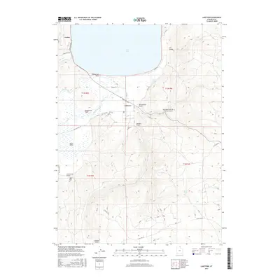
2017 Map of Laketown
USGS Topo · Published 2017About this map
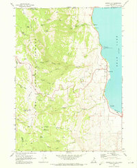
Laketown sits at the southern tip of Bear Lake, serving as a focal point for this high-altitude valley's agricultural and recreational life. The landscape is defined by the transition from the turquoise waters at Rendezvous Beach to the steep, dissected terrain of the Bear River Range, where deep incisions like Laketown Canyon and Old Laketown Canyon drain toward the lake. This 2017 survey reveals a grid of rural roads and residential clusters, including the settlement of Garden and the broader expanse of Meadowville Valley. Genealogists and local historians can locate established burial grounds like the Laketown Cem and the more remote Round Valley Cem near Cottonwood Canyon. The importance of water in this arid environment is evident in the naming of perennial sources such as Falula Spring and Kearl Spring, which have supported ranching and settlement in the area for generations.
Find a feature on this map
38 named features on this map. Tap any name to fly to it.
Don’t see what you’re looking for? This feature index may not catch every label — zoom into the map to look around manually.
Map Details
Editions of this 2017 Laketown Map
This is the sole edition of this map. No revisions or reprints were ever made.
Other maps of this area

1912 · Randolph
USGS Topo · 1:125,000

1954 · Ogden
USGS Topo · 1:250,000

1958 · Ogden
USGS Topo · 1:250,000

1960 · Ogden
USGS Topo · 1:250,000

1968 · Randolph
USGS Topo · 1:24,000

1969 · Sheeppen Creek
USGS Topo · 1:24,000
1969 · Red Spur Mtn
USGS Topo · 1:24,000
1969 · Meadowville
USGS Topo · 1:24,000
1969 · Bear Lake South
USGS Topo · 1:24,000
1969 · Garden City
USGS Topo · 1:24,000