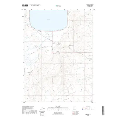
2020 Map of Laketown
USGS Topo · Published 2020About this map
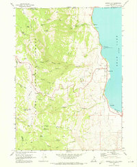
Laketown sits at the southern tip of Bear Lake, serving as a central hub for this corner of Rich County. The town is situated where the open expanse of Meadowville Valley meets the rising terrain of Old Laketown Canyon and Laketown Canyon. To the west, the landscape transitions into Round Valley, where local history is preserved at the Round Valley Cem. This area is defined by its transition from the lakeshore at Rendezvous Beach to the steep, drainage-carved slopes of Cottonwood Canyon and Pine Canyon. Water is a critical element of the local geography, with Big Creek, Kearl Spring, and Falula Spring feeding the lowlands. The grid of local roads, such as N Main St and SE Round Valley Rd, traces the movement of residents between the lake, the valley farms, and the high country of the Bear River Range.
Find a feature on this map
34 named features on this map. Tap any name to fly to it.
Don’t see what you’re looking for? This feature index may not catch every label — zoom into the map to look around manually.
Map Details
Editions of this 2020 Laketown Map
This is the sole edition of this map. No revisions or reprints were ever made.
Other maps of this area

1912 · Randolph
USGS Topo · 1:125,000

1954 · Ogden
USGS Topo · 1:250,000

1958 · Ogden
USGS Topo · 1:250,000

1960 · Ogden
USGS Topo · 1:250,000

1968 · Randolph
USGS Topo · 1:24,000

1969 · Sheeppen Creek
USGS Topo · 1:24,000
1969 · Red Spur Mtn
USGS Topo · 1:24,000
1969 · Meadowville
USGS Topo · 1:24,000
1969 · Bear Lake South
USGS Topo · 1:24,000
1969 · Garden City
USGS Topo · 1:24,000