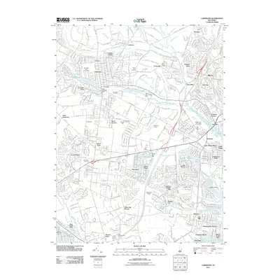
2011 Map of Lakewood
USGS Topo · Published 2011About this map
Georgian Court University and the historic core of Lakewood serve as the focal point for this survey of eastern New Jersey's suburban and coastal landscape. The region's intricate water network is defined by the North Branch Metedeconk River and South Branch Metedeconk River, which feed into prominent local bodies like Lake Carasaljo and Forge Pond. These waterways historically dictated the development patterns of early settlements such as Lanes Mills and Larrabees, which have since integrated into the modern residential fabric of Bricktown and Silverton.
Find a feature on this map
80 named features on this map. Tap any name to fly to it.
Don’t see what you’re looking for? This feature index may not catch every label — zoom into the map to look around manually.
Map Details
Editions of this 2011 Lakewood Map
This is the sole edition of this map. No revisions or reprints were ever made.
Other maps of this area

1884 · Whitings
USGS Topo · 1:62,500

1888 · Barnegat
USGS Topo · 1:62,500

1888 · Asbury Park
USGS Topo · 1:62,500

1888 · Cassville
USGS Topo · 1:62,500

1888 · Whitings
USGS Topo · 1:62,500

1893 · Asbury Park
USGS Topo · 1:62,500

1893 · Barnegat
USGS Topo · 1:62,500

1894 · Cassville
USGS Topo · 1:62,500

1898 · Barnegat
USGS Topo · 1:62,500

1900 · Cassville
USGS Topo · 1:62,500