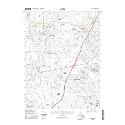
2016 Map of Lakewood
USGS Topo · Published 2016About this map
The South Branch Metedeconk River and North Branch Metedeconk River converge near the densely developed center of Lakewood, reflecting the heavy urbanization of northern Ocean County. This 2016 survey highlights a complex network of residential communities and educational institutions, including the expansive campus of Georgian Court Univ and religious centers such as Bais Medrash Toras Chesed and Yeshiva Toras Chaim. The landscape is characterized by numerous small lakes and managed water bodies like Lake Manetta and Lake Shenandoah, which are interspersed among established neighborhoods like Coventry Square and Parkway Pines. To the south, the terrain transitions into the planned communities of Leisure Village and Holiday City, while the Garden State Pkwy serves as the primary corridor connecting these Jersey Shore inland settlements.
Find a feature on this map
77 named features on this map. Tap any name to fly to it.
Don’t see what you’re looking for? This feature index may not catch every label — zoom into the map to look around manually.
Map Details
Editions of this 2016 Lakewood Map
This is the sole edition of this map. No revisions or reprints were ever made.
Other maps of this area

1884 · Whitings
USGS Topo · 1:62,500

1888 · Barnegat
USGS Topo · 1:62,500

1888 · Asbury Park
USGS Topo · 1:62,500

1888 · Cassville
USGS Topo · 1:62,500

1888 · Whitings
USGS Topo · 1:62,500

1893 · Asbury Park
USGS Topo · 1:62,500

1893 · Barnegat
USGS Topo · 1:62,500

1894 · Cassville
USGS Topo · 1:62,500

1898 · Barnegat
USGS Topo · 1:62,500

1900 · Cassville
USGS Topo · 1:62,500