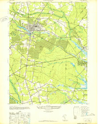
1947 Map of Lakewood
USGS Topo · Published 1947About this map
Lakewood serves as the primary hub of this late 1940s survey, centered at the confluence of the North Branch Metedeconk River and the South Branch Metedeconk River. The map details a landscape transitioning from a dense town grid to expansive wooded tracts and water features like Lake Carasaljo and Lake Manetta. Key institutional landmarks such as Georgian Court College and the Paul Kimball Hosp are clearly marked, alongside essential infrastructure like the Sewage Disposal Plant.
Find a feature on this map
65 named features on this map. Tap any name to fly to it.
Don’t see what you’re looking for? This feature index may not catch every label — zoom into the map to look around manually.
Map Details
Editions of this 1947 Lakewood Map
This is the sole edition of this map. No revisions or reprints were ever made.
Other maps of this area

1884 · Whitings
USGS Topo · 1:62,500

1888 · Barnegat
USGS Topo · 1:62,500

1888 · Asbury Park
USGS Topo · 1:62,500

1888 · Cassville
USGS Topo · 1:62,500

1888 · Whitings
USGS Topo · 1:62,500

1893 · Asbury Park
USGS Topo · 1:62,500

1893 · Barnegat
USGS Topo · 1:62,500

1894 · Cassville
USGS Topo · 1:62,500

1898 · Barnegat
USGS Topo · 1:62,500

1900 · Cassville
USGS Topo · 1:62,500