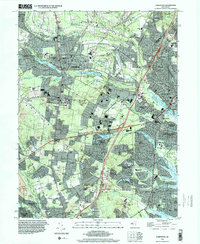
1995 Map of Lakewood
USGS Topo · Published 2000About this map
Lakewood and its surrounding communities in Ocean and Monmouth counties appear during a period of significant suburban development at the end of the 20th century. The landscape is defined by the South Branch Metedeconk River and several artificial impoundments like Lake Carasaljo and Lake Shenandoah. Institutional landmarks are prominent, including the campus of Georgian Court College and the religious center Beth Medrash Govoha. This mid-90s landscape reveals the transition from early industrial and resource extraction activities, evidenced by several sites marked as Former Mine and various Gravel Pits, to large-scale residential enclaves like Leisure Village and Holiday City. Significant infrastructure, including the Garden State Parkway and Lakewood Airport, anchors the region's connectivity between established town centers and newer sprawling developments near Silver Bay.
Find a feature on this map
98 named features on this map. Tap any name to fly to it.
Don’t see what you’re looking for? This feature index may not catch every label — zoom into the map to look around manually.
Map Details
Editions of this 1995 Lakewood Map
This is the sole edition of this map. No revisions or reprints were ever made.
Other maps of this area

1884 · Whitings
USGS Topo · 1:62,500

1888 · Barnegat
USGS Topo · 1:62,500

1888 · Asbury Park
USGS Topo · 1:62,500

1888 · Cassville
USGS Topo · 1:62,500

1888 · Whitings
USGS Topo · 1:62,500

1893 · Asbury Park
USGS Topo · 1:62,500

1893 · Barnegat
USGS Topo · 1:62,500

1894 · Cassville
USGS Topo · 1:62,500

1898 · Barnegat
USGS Topo · 1:62,500

1900 · Cassville
USGS Topo · 1:62,500