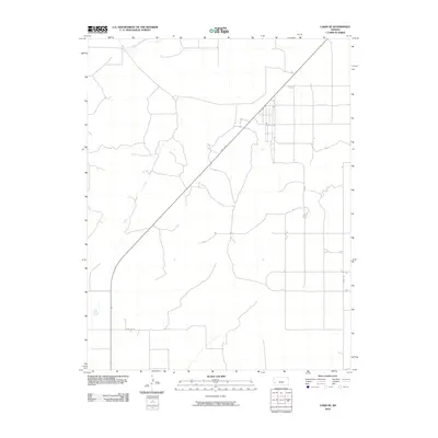
2010 Map of Lakin SE
USGS Topo · Published 2010About this map
Bear Creek meanders through this portion of Kearny County, marking the transition between the high plains and the managed water systems that define modern Kansas agriculture. The landscape is structured by a grid of rural infrastructure, where State Hwy 25 cuts diagonally across the terrain, intersecting local routes like Co Rd 35 and Lakin Ln. This 2010 survey highlights the region's reliance on irrigation and water management, notably shown by the presence of the Southside Ditch in the northern reaches of the quadrangle. The map reveals a sparsely populated area where the placement of roads and water canals dictates the pattern of land use and property boundaries in this Western Kansas prairie.
Find a feature on this map
5 named features on this map. Tap any name to fly to it.
Don’t see what you’re looking for? This feature index may not catch every label — zoom into the map to look around manually.
Map Details
Editions of this 2010 Lakin SE Map
This is the sole edition of this map. No revisions or reprints were ever made.
Other maps of this area

1891 · Larned
USGS Topo · 1:125,000

1900 · Lakin
USGS Topo · 1:125,000

1955 · Dodge City
USGS Topo · 1:250,000

1958 · Dodge City
USGS Topo · 1:250,000

1959 · Dodge City
USGS Topo · 1:250,000

1959 · Ulysses NW
USGS Topo · 1:24,000

1959 · Ulysses NE
USGS Topo · 1:24,000

1959 · Hickok NW
USGS Topo · 1:24,000
1960 · Deerfield SW
USGS Topo · 1:24,000

1960 · Deerfield
USGS Topo · 1:24,000