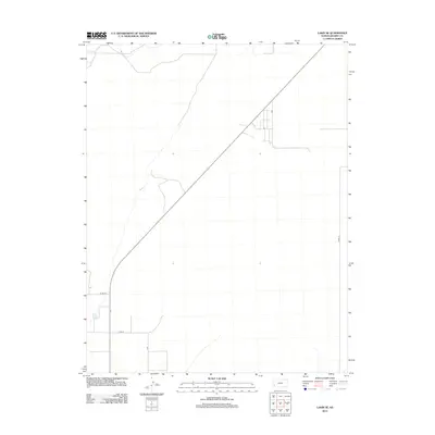
2012 Map of Lakin SE
USGS Topo · Published 2012About this map
Bear Cr carves a subtle path through this landscape south of the Arkansas River valley, serving as the primary natural drainage in an area defined by long-distance transit and rural section lines. This 2012 survey by the U.S. Geological Survey illustrates the modern infrastructure of the High Plains, where the diagonal corridor of K-25 cuts across the established township and range grid. Local movement is facilitated by a network of named routes including Lakin Ln, Co Rd-34, and Co Rd-35, which connect the outlying farmsteads and agricultural plots of south-central Kearny County. The map reflects a contemporary era of precise land management, showing the intersection of natural waterways and the rigid geometry of western Kansas roads.
Find a feature on this map
5 named features on this map. Tap any name to fly to it.
Don’t see what you’re looking for? This feature index may not catch every label — zoom into the map to look around manually.
Map Details
Editions of this 2012 Lakin SE Map
This is the sole edition of this map. No revisions or reprints were ever made.
Other maps of this area

1891 · Larned
USGS Topo · 1:125,000

1900 · Lakin
USGS Topo · 1:125,000

1955 · Dodge City
USGS Topo · 1:250,000

1958 · Dodge City
USGS Topo · 1:250,000

1959 · Dodge City
USGS Topo · 1:250,000

1959 · Ulysses NW
USGS Topo · 1:24,000

1959 · Ulysses NE
USGS Topo · 1:24,000

1959 · Hickok NW
USGS Topo · 1:24,000
1960 · Deerfield SW
USGS Topo · 1:24,000

1960 · Deerfield
USGS Topo · 1:24,000