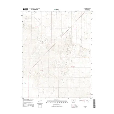
2015 Map of Lakin SE
USGS Topo · Published 2015About this map
The High Plains landscape of Kearny County is defined by a sparse network of section-line roads and wide-open prairie. This 2015 survey of the region south of the Arkansas River valley shows the transition of the land into the sand hills of western Kansas. Evidence of the Public Land Survey System is omnipresent, as seen in the boundaries of t25s r37w, t25s r36w, t26s r37w, and t26s r36w. Human activity is primarily traced through the local infrastructure, including north-south corridors like Lakin Ln and the east-west routes of Co Rd 34 and Co Rd 35. The map provides a clear picture of modern land management and township organization in this rural agricultural and rangeland environment.
Find a feature on this map
7 named features on this map. Tap any name to fly to it.
Don’t see what you’re looking for? This feature index may not catch every label — zoom into the map to look around manually.
Map Details
Editions of this 2015 Lakin SE Map
This is the sole edition of this map. No revisions or reprints were ever made.
Other maps of this area

1891 · Larned
USGS Topo · 1:125,000

1900 · Lakin
USGS Topo · 1:125,000

1955 · Dodge City
USGS Topo · 1:250,000

1958 · Dodge City
USGS Topo · 1:250,000

1959 · Dodge City
USGS Topo · 1:250,000

1959 · Ulysses NW
USGS Topo · 1:24,000

1959 · Ulysses NE
USGS Topo · 1:24,000

1959 · Hickok NW
USGS Topo · 1:24,000
1960 · Deerfield SW
USGS Topo · 1:24,000

1960 · Deerfield
USGS Topo · 1:24,000