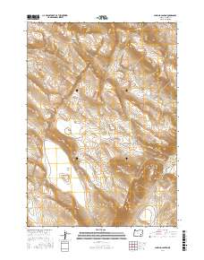
2017 Map of Lambing Canyon
USGS Topo · Published 2017About this map
Lambing Canyon and the surrounding high desert of Harney County reveal a landscape defined by seasonal water management and wide basin floors. This remote section of the Alvord Valley transitions from the slopes of Neals Hill down to expansive basins like Burnt Flat and Orejana Flat. The reliance on surface water in this arid environment is evident through a network of small catchments, including Louies Draw Reservoir, Quail Cr Reservoir, and N Quail Cr Reservoir. These features, along with ephemeral bodies like Neals Lake and Mays Lake, reflect the traditional ranching infrastructure of the Oregon outback. The topography is further etched by drainage systems such as Road Canyon Cr and Oriana Cr, which cut through the draws and flats. Movement through the area is guided by primitive routes like the Juniper Grade and the more established Fields-Denio Rd, highlighting the sparse but vital transport network in this corner of the state.
Find a feature on this map
30 named features on this map. Tap any name to fly to it.
Don’t see what you’re looking for? This feature index may not catch every label — zoom into the map to look around manually.
Map Details
Editions of this 2017 Lambing Canyon Map
This is the sole edition of this map. No revisions or reprints were ever made.
Other maps of this area

1955 · Burns
USGS Topo · 1:250,000

1955 · Adel
USGS Topo · 1:250,000

1957 · Adel
USGS Topo · 1:250,000

1958 · Burns
USGS Topo · 1:250,000

1958 · Adel
USGS Topo · 1:250,000

1959 · Burns
USGS Topo · 1:250,000

1962 · Adel
USGS Topo · 1:250,000

1974 · Anderson Mtn
USGS Topo · 1:62,500
1974 · Folly Farm
USGS Topo · 1:24,000
1974 · Folly Farm
USGS Topo · 1:62,500