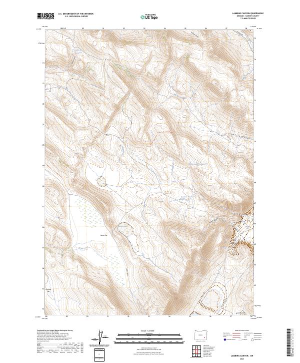
2023 Map of Lambing Canyon
USGS Topo · Published 2023About this map
Marys Lake and a series of high-altitude water management features define this arid stretch of Harney County. The landscape is marked by the seasonal drainage of Oriana Creek and the intricate draws of Lambing Canyon and Road Canyon. These drainage patterns are vital to the ranching geography of the region, where catchments like Louies Draw Reservoir and North Quail Cr Reservoir provide critical resources in a terrain otherwise dominated by expansive flats such as Burnt Flat and Orejana Flat.
Find a feature on this map
28 named features on this map. Tap any name to fly to it.
Don’t see what you’re looking for? This feature index may not catch every label — zoom into the map to look around manually.
Map Details
Editions of this 2023 Lambing Canyon Map
This is the sole edition of this map. No revisions or reprints were ever made.
Other maps of this area

1955 · Burns
USGS Topo · 1:250,000

1955 · Adel
USGS Topo · 1:250,000

1957 · Adel
USGS Topo · 1:250,000

1958 · Burns
USGS Topo · 1:250,000

1958 · Adel
USGS Topo · 1:250,000

1959 · Burns
USGS Topo · 1:250,000

1962 · Adel
USGS Topo · 1:250,000

1974 · Anderson Mtn
USGS Topo · 1:62,500
1974 · Folly Farm
USGS Topo · 1:24,000
1974 · Folly Farm
USGS Topo · 1:62,500