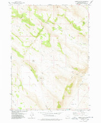
1977 Map of Lambing Canyon
USGS Topo · Published 1978About this map
Lambing Canyon and the surrounding high desert of Harney County are defined by seasonal water sources and rugged topography as surveyed in the mid-1970s. This arid landscape relies on a network of ephemeral drainages and scattered catchments, including Neals Lake and Marys Lake. The presence of Summit Springs in the northeast corner highlights the critical importance of reliable water in this terrain, which is otherwise dominated by broad expanses like Burnt Flat and Oriana Flat.
Find a feature on this map
23 named features on this map. Tap any name to fly to it.
Don’t see what you’re looking for? This feature index may not catch every label — zoom into the map to look around manually.
Map Details
Editions of this 1977 Lambing Canyon Map
This is the sole edition of this map. No revisions or reprints were ever made.
Other maps of this area

1955 · Burns
USGS Topo · 1:250,000

1955 · Adel
USGS Topo · 1:250,000

1957 · Adel
USGS Topo · 1:250,000

1958 · Burns
USGS Topo · 1:250,000

1958 · Adel
USGS Topo · 1:250,000

1959 · Burns
USGS Topo · 1:250,000

1962 · Adel
USGS Topo · 1:250,000

1974 · Anderson Mtn
USGS Topo · 1:62,500
1974 · Folly Farm
USGS Topo · 1:24,000
1974 · Folly Farm
USGS Topo · 1:62,500