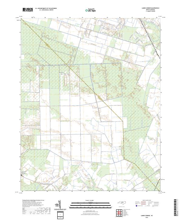
2022 Map of Lambs Corner
USGS Topo · Published 2022About this map
The Great Dismal Swamp dominates this borderland between North Carolina's Camden and Currituck counties, defining a landscape shaped by water and human engineering. An intricate network of drainage channels, including the Guinea Mill Run Canal, Lateral A Canal, and Run Swamp Canal, crisscrosses the low-lying terrain to manage the natural hydrology of the region. This system of canals and creeks, such as Sawyers Cr and Roland Cr, reflects the long history of attempting to tame and utilize the vast wetlands for agriculture and transport.
Find a feature on this map
44 named features on this map. Tap any name to fly to it.
Don’t see what you’re looking for? This feature index may not catch every label — zoom into the map to look around manually.
Map Details
Editions of this 2022 Lambs Corner Map
This is the sole edition of this map. No revisions or reprints were ever made.
Other maps of this area

1939 · Moyock
USGS Topo · 1:62,500

1940 · Lake Drummond
USGS Topo · 1:62,500

1940 · South Mills
USGS Topo · 1:62,500

1945 · Lake Drummond
USGS Topo · 1:62,500

1946 · Moyock
USGS Topo · 1:62,500

1948 · Elizabeth City
USGS Topo · 1:62,500

1952 · South Mills
USGS Topo · 1:62,500

1953 · Norfolk
USGS Topo · 1:250,000
1954 · Creeds
USGS Topo · 1:24,000
1954 · Lake Drummond SE
USGS Topo · 1:24,000