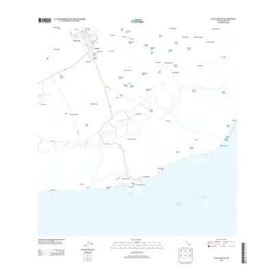
2013 Map of Lanai South
USGS Topo · Published 2013About this map
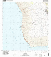
Lānaʙi City and the adjacent settlement of Lalakoa anchor the northern reaches of this topographic survey, where a planned grid of streets like Fraser Ave and Queens St meets the open agricultural and ranching landscape. The geography is defined by the massive Palawai Basin and a series of sharp ridges and deep gulches, including Kaiholena Gulch and Kapohaku Gulch, that drain toward the southern coast. To the west, Lānaʙi Airport serves the island's connectivity, while the interior rises toward the high point of Lānaʙihale. The southern shoreline is marked by prominent marine features such as Hulopoʙe Bay, Sharks Bay, and the striking Nakalahale Cliff. This 2013 data provides a clear record of the island's modern road network, including the primary artery of Highway 440 and the rugged Lanaihale Trl that traverses the eastern heights.
Find a feature on this map
94 named features on this map. Tap any name to fly to it.
Don’t see what you’re looking for? This feature index may not catch every label — zoom into the map to look around manually.
Map Details
Editions of this 2013 Lanai South Map
This is the sole edition of this map. No revisions or reprints were ever made.
Other maps of this area

1923 · Island of Lanai
USGS Topo · 1:31,680

1925 · Island of Lanai
USGS Topo · 1:62,500

1954 · Maui
USGS Topo · 1:250,000

1966 · Maui
USGS Topo · 1:250,000

1974 · Maui
USGS Topo · 1:250,000
1984 · Lanai North
USGS Topo · 1:25,000
1984 · Lanai South
USGS Topo · 1:25,000
1992 · Haalelepaakai
USGS Topo · 1:24,000
1992 · Lanai City
USGS Topo · 1:24,000
2013 · Lanai North OE E
USGS Topo · 1:24,000