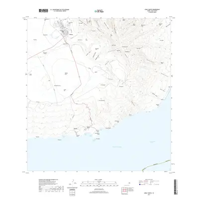
2017 Map of Lanai South
USGS Topo · Published 2017About this map
Lāna‘i City serves as the central hub of this island survey, situated atop the plateau where the residential grid of streets like Fraser Ave, Lanai Ave, and Queens St meets the open terrain of Lalakoa. The landscape transitions from these settled areas into the dramatic central highlands, crowned by the peak of Lāna‘ihale and the narrow crests of Kamiki Ridge and Palea Ridge. A dense network of gulches, such as Iwia ole Gulch and Kaiholena Gulch, carves the slopes leading down toward the southern coastline.
Find a feature on this map
95 named features on this map. Tap any name to fly to it.
Don’t see what you’re looking for? This feature index may not catch every label — zoom into the map to look around manually.
Map Details
Editions of this 2017 Lanai South Map
This is the sole edition of this map. No revisions or reprints were ever made.
Other maps of this area

1923 · Island of Lanai
USGS Topo · 1:31,680

1925 · Island of Lanai
USGS Topo · 1:62,500

1954 · Maui
USGS Topo · 1:250,000

1966 · Maui
USGS Topo · 1:250,000

1974 · Maui
USGS Topo · 1:250,000
1984 · Lanai North
USGS Topo · 1:25,000
1984 · Lanai South
USGS Topo · 1:25,000
1992 · Haalelepaakai
USGS Topo · 1:24,000
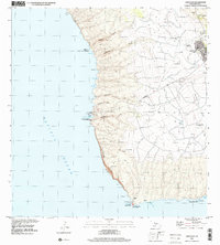
1992 · Lanai City
USGS Topo · 1:24,000
2013 · Lanai North OE E
USGS Topo · 1:24,000