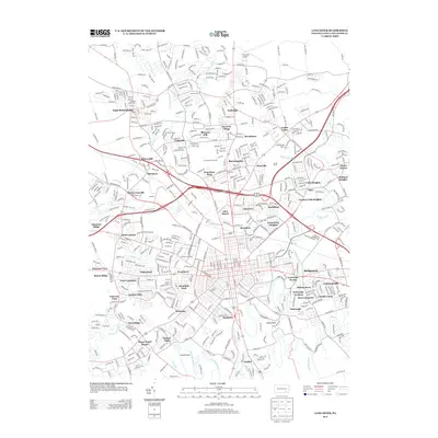
2013 Map of Lancaster
USGS Topo · Published 2013About this map
Conestoga River and Little Conestoga Cr define the hydrological landscape of this region, framing a densely developed suburban and industrial corridor north of the city. The area is marked by a complex network of residential subdivisions and historical crossroads settlements such as Neffsville, Landis Valley, and East Petersburg. Transportation infrastructure is a dominant theme, ranging from the sprawling grounds of the Lancaster Airport in the north to the Norfolk Southern rail lines and major thoroughfares like the Fruitville Pike.
Find a feature on this map
564 named features on this map. Tap any name to fly to it.
Don’t see what you’re looking for? This feature index may not catch every label — zoom into the map to look around manually.
Map Details
Editions of this 2013 Lancaster Map
This is the sole edition of this map. No revisions or reprints were ever made.
Other maps of this area

1902 · Lancaster
USGS Topo · 1:62,500

1904 · Lancaster
USGS Topo · 1:62,500

1906 · New Holland
USGS Topo · 1:62,500

1908 · New Holland
USGS Topo · 1:62,500

1912 · Quarryville
USGS Topo · 1:62,500

1912 · Mc Calls Ferry
USGS Topo · 1:62,500

1941 · New Holland
USGS Topo · 1:62,500

1943 · Lancaster
USGS Topo · 1:62,500

1943 · Quarryville
USGS Topo · 1:62,500

1943 · Mc Calls Ferry
USGS Topo · 1:62,500
Featured Places
- Lancaster, PA
- West Lampeter Township, PA
- Willow Street, West Lampeter Township
- Millersville, PA
- East Petersburg, PA