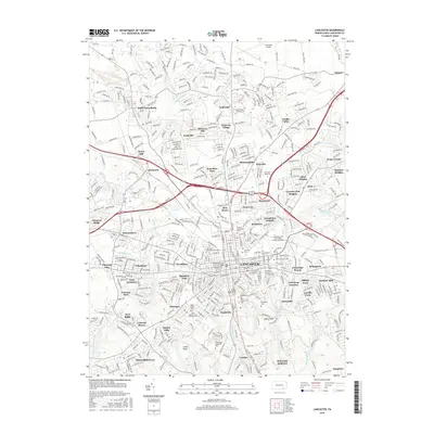
2016 Map of Lancaster
USGS Topo · Published 2016About this map
The city of Lancaster anchors this 2016 survey, revealing a dense urban core and expanding suburban neighborhoods throughout Lancaster County. Historically significant burial grounds like Lancaster Cem and Woodward Hill Cem are clearly mapped alongside prominent educational institutions including the Lancaster Theological Seminary and the Thaddeus Stevens Coll of Technology. The landscape is defined by the winding course of the Conestoga River and its many tributaries such as Little Conestoga Cr and Bachman Run.
Find a feature on this map
96 named features on this map. Tap any name to fly to it.
Don’t see what you’re looking for? This feature index may not catch every label — zoom into the map to look around manually.
Map Details
Editions of this 2016 Lancaster Map
This is the sole edition of this map. No revisions or reprints were ever made.
Other maps of this area

1902 · Lancaster
USGS Topo · 1:62,500

1904 · Lancaster
USGS Topo · 1:62,500

1906 · New Holland
USGS Topo · 1:62,500

1908 · New Holland
USGS Topo · 1:62,500

1912 · Quarryville
USGS Topo · 1:62,500

1912 · Mc Calls Ferry
USGS Topo · 1:62,500

1941 · New Holland
USGS Topo · 1:62,500

1943 · Lancaster
USGS Topo · 1:62,500

1943 · Quarryville
USGS Topo · 1:62,500

1943 · Mc Calls Ferry
USGS Topo · 1:62,500
Featured Places
- Lancaster, PA
- West Lampeter Township, PA
- Willow Street, West Lampeter Township
- Millersville, PA
- East Petersburg, PA