
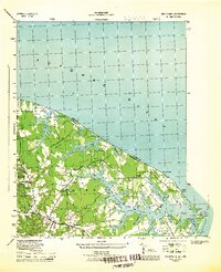
2010 Map of Lancaster
USGS Topo · Published 2010About this map
Lancaster stands as the central hub of this Northern Neck landscape, where the tides of the Great Wicomico River and the Western Branch Corrotoman River shape the geography. The map reveals a dense network of crossroads communities that define the region's social history, including Wicomico Church, Browns Store, and Regina. Moving inland from the waterfront landings like Indian Point Landing and Cedar Point Landing, the terrain transitions into a mosaic of wetlands such as McMahon Swamp and Callahan Swamp.
Find a feature on this map
67 named features on this map. Tap any name to fly to it.
Don’t see what you’re looking for? This feature index may not catch every label — zoom into the map to look around manually.
Map Details
Editions of this 2010 Lancaster Map
This is the sole edition of this map. No revisions or reprints were ever made.
Other maps of this area

1916 · Kilmarnock
USGS Topo · 1:48,000

1917 · Heathsville
USGS Topo · 1:48,000

1917 · Urbanna
USGS Topo · 1:62,500

1917 · Morattico
USGS Topo · 1:62,500

1917 · Kilmarnock
USGS Topo · 1:62,500

1918 · Morattico
USGS Topo · 1:62,500

1926 · Morattico
USGS Topo · 1:62,500

1942 · Kilmarnock
USGS Topo · 1:62,500

1943 · Richmond
USGS Topo · 1:250,000
1944 · Sunnybank
USGS Topo · 1:31,680