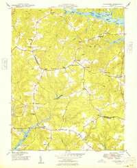
1949 Map of Lancaster
USGS Topo · Published 1949About this map
The Great Wicomico River and the Corrotoman River frame this mid-century portrait of Virginia’s Northern Neck, where the boundary between Northumberland and Lancaster counties winds through a landscape of tidal creeks and crossroads settlements. Significant educational and religious landmarks such as the Booker T Washington Sch, New Lancaster Sch, and Wicomico Church appear alongside community centers like Browns Store and Regina. The importance of the regional waterfront is evidenced by Sampsons Wharf and several landings including Deep Landing and Betz Landing. Inland, the terrain is dotted with small family-named locales like Beanes Corners and McNeals Corner, while the Miskimon Lookout Tower stands as a sentinel over the wooded headwaters of the Western Branch. This 1940s survey reveals a traditional rural structure of mills, such as Davis Mill, and numerous country churches including Providence Ch and Willie Chapel, serving a population closely tied to both the land and the Chesapeake’s tributaries.
Find a feature on this map
55 named features on this map. Tap any name to fly to it.
Don’t see what you’re looking for? This feature index may not catch every label — zoom into the map to look around manually.
Map Details
Editions of this 1949 Lancaster Map
2 editions found
Other maps of this area

1916 · Kilmarnock
USGS Topo · 1:48,000

1917 · Heathsville
USGS Topo · 1:48,000

1917 · Urbanna
USGS Topo · 1:62,500

1917 · Morattico
USGS Topo · 1:62,500

1917 · Kilmarnock
USGS Topo · 1:62,500

1918 · Morattico
USGS Topo · 1:62,500

1926 · Morattico
USGS Topo · 1:62,500

1942 · Kilmarnock
USGS Topo · 1:62,500

1943 · Richmond
USGS Topo · 1:250,000
1944 · Sunnybank
USGS Topo · 1:31,680