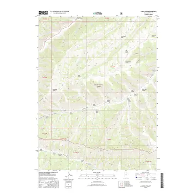
2017 Map of Lance Canyon
USGS Topo · Published 2017About this map
Ashley National Forest covers the central portion of this Duchesne County landscape, dominated by a complex system of ridges and drainage basins. High elevations are defined by prominent features like Cottonwood Ridge and Wild Horse Ridge, which overlook deeply incised terrain such as Quitchampau Canyon and Tabby Canyon. To the south, the Bad Land Cliffs create a sharp geographic break, transitioning toward the Argyle Cr drainage.
Find a feature on this map
47 named features on this map. Tap any name to fly to it.
Don’t see what you’re looking for? This feature index may not catch every label — zoom into the map to look around manually.
Map Details
Editions of this 2017 Lance Canyon Map
This is the sole edition of this map. No revisions or reprints were ever made.
Other maps of this area

1885 · Uinta
USGS Topo · 1:250,000

1886 · Price River
USGS Topo · 1:250,000

1896 · Price River
USGS Topo · 1:250,000

1939 · Duchesne
USGS Topo · 1:125,000

1954 · Salt Lake City
USGS Topo · 1:250,000

1956 · Price
USGS Topo · 1:250,000

1958 · Salt Lake City
USGS Topo · 1:250,000

1960 · Salt Lake City
USGS Topo · 1:250,000

1960 · Price
USGS Topo · 1:250,000

1962 · Price
USGS Topo · 1:250,000