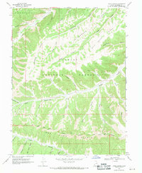
1968 Map of Lance Canyon
USGS Topo · Published 1971About this map
The Old Indian Treaty Boundary carves a diagonal line across this 1968 landscape, marking a significant historical administrative division south of the Ashley National Forest. The terrain is defined by a complex network of deep drainages, including Lance Canyon and Sowers Canyon, which feed into major watercourses like Indian Canyon and Fivemile Creek. This high-desert environment shows evidence of twentieth-century resource exploration, noted by scattered Drill Hole locations across the ridges.
Find a feature on this map
38 named features on this map. Tap any name to fly to it.
Don’t see what you’re looking for? This feature index may not catch every label — zoom into the map to look around manually.
Map Details
Editions of this 1968 Lance Canyon Map
This is the sole edition of this map. No revisions or reprints were ever made.
Other maps of this area

1885 · Uinta
USGS Topo · 1:250,000

1886 · Price River
USGS Topo · 1:250,000

1896 · Price River
USGS Topo · 1:250,000

1939 · Duchesne
USGS Topo · 1:125,000

1954 · Salt Lake City
USGS Topo · 1:250,000

1956 · Price
USGS Topo · 1:250,000

1958 · Salt Lake City
USGS Topo · 1:250,000

1960 · Salt Lake City
USGS Topo · 1:250,000

1960 · Price
USGS Topo · 1:250,000

1962 · Price
USGS Topo · 1:250,000