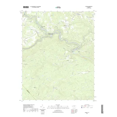
2019 Map of Lancing
USGS Topo · Published 2019About this map
The Obed Wild And Scenic River carves a deep, winding path through the northern reaches of the Cumberland Plateau in Morgan County. This landscape is defined by the sharp relief of the river gorge, featuring a series of white-water landmarks such as The Grundy Rapids, Camel Rapids, and Nemo Rapids. Small rural communities like Lancing and Shady Grove are positioned on the higher ground above the canyon, while the settlement of Nemo sits at the confluence of the Emory River and the Obed. For genealogists and local historians, the map is a primary source for locating family burial grounds, including the Zumstein Cem, Nitzschke Cem, and Hamby Cem, many of which are tucked away near old mountain roads. Significant river crossings like Jett Bridge and Nemo Bridge anchor the transportation network through this heavily forested region.
Find a feature on this map
104 named features on this map. Tap any name to fly to it.
Don’t see what you’re looking for? This feature index may not catch every label — zoom into the map to look around manually.
Map Details
Editions of this 2019 Lancing Map
This is the sole edition of this map. No revisions or reprints were ever made.
Other maps of this area

1887 · Kingston
USGS Topo · 1:125,000

1891 · Kingston
USGS Topo · 1:125,000

1893 · Kingston
USGS Topo · 1:125,000

1895 · Wartburg
USGS Topo · 1:125,000

1896 · Wartburg
USGS Topo · 1:125,000

1935 · Gobey
USGS Topo · 1:24,000

1935 · Camp Austin
USGS Topo · 1:24,000

1935 · Harriman
USGS Topo · 1:24,000

1935 · Lancing
USGS Topo · 1:24,000

1935 · Pilot Mountain
USGS Topo · 1:24,000