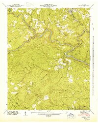
1946 Map of Lancing
USGS Topo · Published 1948About this map
The confluence of the Obed River and Emory River anchors this 1940s landscape, illustrating a rugged section of the Cumberland Plateau before modern development encroached. The Southern railroad line skirts the northern and eastern edges of the terrain, connecting the settlement of Lancing to the broader regional economy. Deep within the winding river valleys and along the ridges of Hatfield Mountain, the map reveals the sparse human imprint of the era, from the isolated Catoosa settlement to the historic Howard Mill site on Clear Creek. Local genealogy and land-use patterns are evident in the placement of the Kubly Cem and Nelson Cem, as well as the numerous named watercourses like White Horse Creek and Crab Orchard Creek that drain the high reaches of the Crab Orchard Mountains.
Find a feature on this map
47 named features on this map. Tap any name to fly to it.
Don’t see what you’re looking for? This feature index may not catch every label — zoom into the map to look around manually.
Map Details
Editions of this 1946 Lancing Map
This is the sole edition of this map. No revisions or reprints were ever made.
Other maps of this area

1887 · Kingston
USGS Topo · 1:125,000

1891 · Kingston
USGS Topo · 1:125,000

1893 · Kingston
USGS Topo · 1:125,000

1895 · Wartburg
USGS Topo · 1:125,000

1896 · Wartburg
USGS Topo · 1:125,000

1935 · Gobey
USGS Topo · 1:24,000

1935 · Camp Austin
USGS Topo · 1:24,000

1935 · Harriman
USGS Topo · 1:24,000

1935 · Lancing
USGS Topo · 1:24,000

1935 · Pilot Mountain
USGS Topo · 1:24,000