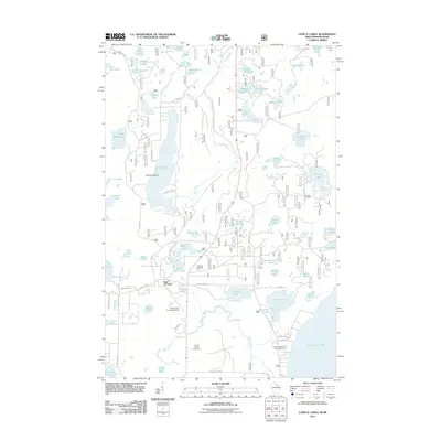
2011 Map of Land O' Lakes
USGS Topo · Published 2011About this map
Land O' Lakes serves as the central hub of this lake-strewn landscape on the Wisconsin-Michigan border. The terrain is defined by a dense network of glacial water bodies, from the prominent Duck Lake and its Reimers Island to smaller, isolated features like Chickadee Lake and Devils Head Lake. Transport and recreation are central to the area's layout, evidenced by the Kings Land O' Lakes Airport and the Ski Hill Winter Sports Area. Historical routes like Old Military Rd intersect with local roads such as Black Bear Rd and W Moon Lake Rd, connecting various summer homes and camps. The map also captures several public spaces, including the Gateway Roadside Park and the Lac Vieux Desert Campground at the edge of the expansive Lac Vieux Desert.
Find a feature on this map
71 named features on this map. Tap any name to fly to it.
Don’t see what you’re looking for? This feature index may not catch every label — zoom into the map to look around manually.
Map Details
Editions of this 2011 Land O' Lakes Map
This is the sole edition of this map. No revisions or reprints were ever made.
Other maps of this area

1938 · Phelps
USGS Topo · 1:48,000

1946 · Star Lake
USGS Topo · 1:48,000

1950 · Phelps
USGS Topo · 1:48,000

1950 · Star Lake
USGS Topo · 1:48,000

1952 · Watersmeet
USGS Topo · 1:62,500

1952 · Thayer
USGS Topo · 1:62,500

1955 · Starlake
USGS Topo · 1:62,500

1956 · Phelps
USGS Topo · 1:62,500

1958 · Iron River
USGS Topo · 1:250,000

1960 · Iron River
USGS Topo · 1:250,000