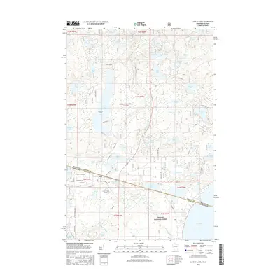
2015 Map of Land O' Lakes
USGS Topo · Published 2015About this map
Land O' Lakes serves as the focal point of this northern lake-country survey, straddling the border between Wisconsin and Michigan. The landscape is defined by an intricate network of water bodies, from the expansive Duck Lake and Dinner Lake to smaller basins like Honey Lake and Kvidera Lake. This concentration of glacial lakes sits at the intersection of two major protected areas, the Ottawa National Forest and the Nicolet National Forest. Transport and access follow a mix of modern infrastructure and heritage routes, including Old Military Rd and the Kings Land O' Lakes Airport. The map documents a rugged timberland and recreational geography where water dictates the location of residential developments along Moon Lake Rd and Sunset Cove.
Find a feature on this map
91 named features on this map. Tap any name to fly to it.
Don’t see what you’re looking for? This feature index may not catch every label — zoom into the map to look around manually.
Map Details
Editions of this 2015 Land O' Lakes Map
This is the sole edition of this map. No revisions or reprints were ever made.
Other maps of this area

1938 · Phelps
USGS Topo · 1:48,000

1946 · Star Lake
USGS Topo · 1:48,000

1950 · Phelps
USGS Topo · 1:48,000

1950 · Star Lake
USGS Topo · 1:48,000

1952 · Watersmeet
USGS Topo · 1:62,500

1952 · Thayer
USGS Topo · 1:62,500

1955 · Starlake
USGS Topo · 1:62,500

1956 · Phelps
USGS Topo · 1:62,500

1958 · Iron River
USGS Topo · 1:250,000

1960 · Iron River
USGS Topo · 1:250,000