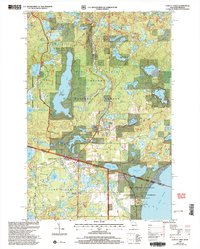
1999 Map of Land O'Lakes
USGS Topo · Published 2005About this map
The borderlands between Vilas County, Wisconsin, and Gogebic County, Michigan, are defined by a complex network of glacial lakes and dense woodlands. Land O' Lakes serves as the primary settlement hub, located just south of the state line. The landscape is a patchwork of protected lands, including the Sylvania Wilderness, Ottawa National Forest, and Chequamegon-Nicolet National Forest. Water is the dominant feature, with major bodies like Duck Lake and Wilson Lake providing access for recreation, noted by several Boat Ramps and the prominent Reimers Island. Transportation and recreation intersect at the Land O' Lakes Airport and along the Agonikak Gateway National Recreation Trail. Local industrial and historical markers are also present, such as a Gravel Pit and a marked Grave site, offering a detailed look at the interface between the wilderness and the small-town infrastructure of the Northwoods at the close of the twentieth century.
Find a feature on this map
66 named features on this map. Tap any name to fly to it.
Don’t see what you’re looking for? This feature index may not catch every label — zoom into the map to look around manually.
Map Details
Editions of this 1999 Land O'Lakes Map
This is the sole edition of this map. No revisions or reprints were ever made.
Other maps of this area

1938 · Phelps
USGS Topo · 1:48,000

1946 · Star Lake
USGS Topo · 1:48,000

1950 · Phelps
USGS Topo · 1:48,000

1950 · Star Lake
USGS Topo · 1:48,000

1952 · Watersmeet
USGS Topo · 1:62,500

1952 · Thayer
USGS Topo · 1:62,500

1955 · Starlake
USGS Topo · 1:62,500

1956 · Phelps
USGS Topo · 1:62,500

1958 · Iron River
USGS Topo · 1:250,000

1960 · Iron River
USGS Topo · 1:250,000