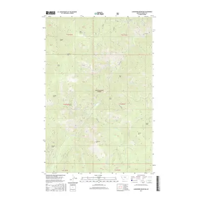
2017 Map of Landowner Mountain
USGS Topo · Published 2017About this map
Lolo National Forest encompasses this high-elevation terrain in Mineral County, defined by a complex drainage system of gulches and creeks. Prominent peaks such as Landowner Mtn and Sunrise Mtn dominate the southern landscape, while Van Ness Point and Eagle Rock provide significant landmarks to the north. This 2017 survey reveals a network of forest access routes, including Trout Creek Rd and Verde Creek Rd, which navigate the steep topography between waterways like Windfall Cr and Russian Bill Cr. The map captures the remote character of the Bitterroot Mountains region, centered on the secluded Windfall Lake. Named features like Bear Gulch, China Gulch, and Hungary Gulch reflect the area's history of prospecting and drainage-based land use within the national forest boundaries.
Find a feature on this map
51 named features on this map. Tap any name to fly to it.
Don’t see what you’re looking for? This feature index may not catch every label — zoom into the map to look around manually.
Map Details
Editions of this 2017 Landowner Mountain Map
This is the sole edition of this map. No revisions or reprints were ever made.
Other maps of this area

1911 · Lolo
USGS Topo · 1:250,000

1913 · Lolo
USGS Topo · 1:250,000

1918 · St Regis
USGS Topo · 1:125,000

1919 · St. Regis
USGS Topo · 1:125,000

1956 · Wallace
USGS Topo · 1:250,000

1956 · Hamilton
USGS Topo · 1:250,000

1957 · Illinois Peak
USGS Topo · 1:62,500

1959 · Hamilton
USGS Topo · 1:250,000

1960 · Wallace
USGS Topo · 1:250,000

1960 · Hamilton
USGS Topo · 1:250,000