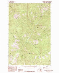
1985 Map of Landowner Mountain
USGS Topo · Published 1985About this map
Lolo National Forest encompasses this high-elevation terrain in Mineral County, Montana, where a complex network of drainages and peaks defines the landscape. The geography is anchored by notable summits like Landowner Mountain and Sunrise Mountain, providing a detailed look at the drainage basins for Trout Creek and its many tributaries. The nomenclature reflects the region's mining and prospecting history, with labels such as China Gulch, Tin Cup Creek, and Russian Bill Creek hinting at the individuals and small-scale operations that once worked these slopes.
Find a feature on this map
28 named features on this map. Tap any name to fly to it.
Don’t see what you’re looking for? This feature index may not catch every label — zoom into the map to look around manually.
Map Details
Editions of this 1985 Landowner Mountain Map
This is the sole edition of this map. No revisions or reprints were ever made.
Other maps of this area

1911 · Lolo
USGS Topo · 1:250,000

1913 · Lolo
USGS Topo · 1:250,000

1918 · St Regis
USGS Topo · 1:125,000

1919 · St. Regis
USGS Topo · 1:125,000

1956 · Wallace
USGS Topo · 1:250,000

1956 · Hamilton
USGS Topo · 1:250,000

1957 · Illinois Peak
USGS Topo · 1:62,500

1959 · Hamilton
USGS Topo · 1:250,000

1960 · Wallace
USGS Topo · 1:250,000

1960 · Hamilton
USGS Topo · 1:250,000