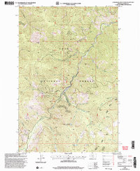
1999 Map of Landowner Mountain
USGS Topo · Published 2003About this map
Lolo National Forest encompasses this high-elevation terrain in Mineral County, dominated by the peaks of Landowner Mountain and Sunrise Mountain. The landscape is defined by a dense network of drainages that feed into larger water bodies such as Trout Creek and Prospect Creek, illustrating the complex hydrology of the Bitterroot Range. Evidence of historical activity is seen in the presence of a Mine located on the eastern slopes of Sunrise Mountain, a common feature in this mineral-rich region of western Montana.
Find a feature on this map
48 named features on this map. Tap any name to fly to it.
Don’t see what you’re looking for? This feature index may not catch every label — zoom into the map to look around manually.
Map Details
Editions of this 1999 Landowner Mountain Map
This is the sole edition of this map. No revisions or reprints were ever made.
Other maps of this area

1911 · Lolo
USGS Topo · 1:250,000

1913 · Lolo
USGS Topo · 1:250,000

1918 · St Regis
USGS Topo · 1:125,000

1919 · St. Regis
USGS Topo · 1:125,000

1956 · Wallace
USGS Topo · 1:250,000

1956 · Hamilton
USGS Topo · 1:250,000

1957 · Illinois Peak
USGS Topo · 1:62,500

1959 · Hamilton
USGS Topo · 1:250,000

1960 · Wallace
USGS Topo · 1:250,000

1960 · Hamilton
USGS Topo · 1:250,000