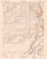
1947 Map of Lanes Bridge
USGS Topo · Published 1947About this map
The San Joaquin River defines the border between Madera and Fresno Counties in this mid-century topographic record. At the crossing point of Lanes Bridge, the landscape transitions from the river bottomland to the agricultural foothills. The area is characterized by a network of essential infrastructure, including numerous windmills dotting the terrain and early thoroughfares like Madera Road and Pole Line Road.
Find a feature on this map
11 named features on this map. Tap any name to fly to it.
Don’t see what you’re looking for? This feature index may not catch every label — zoom into the map to look around manually.
Map Details
Editions of this 1947 Lanes Bridge Map
2 editions found
Other maps of this area

1912 · Mariposa
USGS Topo · 1:125,000

1916 · Sulphur Springs
USGS Topo · 1:24,000

1919 · Sulphur Springs
USGS Topo · 1:31,680

1919 · Little Table Mountain
USGS Topo · 1:31,680

1921 · Daulton
USGS Topo · 1:31,680

1921 · Bullard
USGS Topo · 1:31,680

1922 · Lanes Bridge
USGS Topo · 1:31,680

1922 · Friant
USGS Topo · 1:31,680

1922 · Gregg
USGS Topo · 1:31,680

1923 · Herndon
USGS Topo · 1:31,680