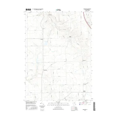
2016 Map of Langford
USGS Topo · Published 2016About this map
Clarksburg and Langford anchor the northern portion of this Erie County landscape, where the terrain is deeply incised by the S Br Eighteenmile Cr and its tributaries. The drainage patterns of Jennings Cr and the N Br Clear Cr reveal a complex hydraulic network feeding into Clear Lake. This 2016 survey captures a predominantly rural area defined by its small crossroads settlements, including Marshfield, Wyandale, and New Oregon. Local history is preserved at the Dittman Cem located along the transition from the rolling uplands down toward the dramatic contours of Kickbush Gulf. The road network, including family-named routes like Yochum Rd and Enser Rd, connects these scattered hamlets, illustrating a settlement pattern that has remained remarkably consistent while transitioning into the twenty-first century.
Find a feature on this map
63 named features on this map. Tap any name to fly to it.
Don’t see what you’re looking for? This feature index may not catch every label — zoom into the map to look around manually.
Map Details
Editions of this 2016 Langford Map
This is the sole edition of this map. No revisions or reprints were ever made.
Other maps of this area

1905 · Eden
USGS Topo · 1:62,500

1907 · Eden
USGS Topo · 1:62,500

1923 · Cattaraugus
USGS Topo · 1:62,500

1924 · Ellicottville
USGS Topo · 1:62,500

1925 · Springville
USGS Topo · 1:62,500

1938 · Cattaraugus
USGS Topo · 1:62,500

1941 · Cattaraugus
USGS Topo · 1:62,500

1941 · Ellicottville
USGS Topo · 1:62,500

1944 · Eden
USGS Topo · 1:62,500

1944 · North Collins
USGS Topo · 1:31,680