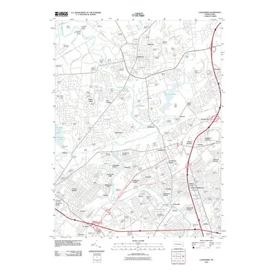
2010 Map of Langhorne
USGS Topo · Published 2010About this map
Neshaminy Creek and its many tributaries, including Newtown Creek and Core Creek, define the suburban landscape of lower Bucks County at the end of the first decade of the 21st century. The map illustrates a dense network of residential developments such as Heights of Newtown, Village Shires, and Deerfield North that sit alongside significant preserved spaces like Tyler State Park. Traces of the region's earlier character are visible through the Scholfield Covered Bridge and Scholfield Ford Covered Bridge, as well as the industrial remains at Flowers Mill. Large cemetery complexes, including Our Lady of Grace Cemetery, King David Cemetery, and Rosedale Memorial Park, serve as local landmarks. This map details the intersection of modern infrastructure, such as the Pennsylvania Turnpike Interchange 28, with established communities like Newtown and Woodside.
Find a feature on this map
171 named features on this map. Tap any name to fly to it.
Don’t see what you’re looking for? This feature index may not catch every label — zoom into the map to look around manually.
Map Details
Editions of this 2010 Langhorne Map
This is the sole edition of this map. No revisions or reprints were ever made.
Other maps of this area

1890 · Lambertville
USGS Topo · 1:62,500

1890 · Doylestown
USGS Topo · 1:62,500

1890 · Burlington
USGS Topo · 1:62,500

1891 · Lambertville
USGS Topo · 1:62,500

1891 · Doylestown
USGS Topo · 1:62,500

1893 · Germantown
USGS Topo · 1:62,500

1893 · Burlington
USGS Topo · 1:62,500

1894 · Lambertville
USGS Topo · 1:62,500

1894 · Germantown
USGS Topo · 1:62,500

1896 · Germantown
USGS Topo · 1:62,500
Featured Places
- Philadelphia, PA
- Bensalem Township, PA
- Middletown Township, PA
- Lower Makefield Township, PA
- Lower Southampton Township, PA