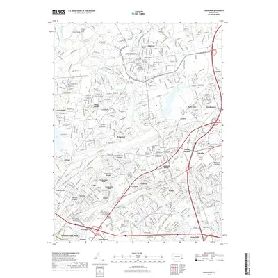
2019 Map of Langhorne
USGS Topo · Published 2019About this map
Neshaminy Creek carves a winding path through this corner of Bucks County, defining the landscape between Newtown and Langhorne. The area is remarkably dense with markers of local heritage, particularly its religious and commemorative sites. In Newtown, the presence of the Historic Presbyterian Church of Newtown Cem and the Newtown Friends Meeting Cem highlights the deep Quaker and Presbyterian roots of the settlement. Further south, the Revolutionary War Burial Site in Langhorne serves as a silent witness to the region's colonial importance.
Find a feature on this map
74 named features on this map. Tap any name to fly to it.
Don’t see what you’re looking for? This feature index may not catch every label — zoom into the map to look around manually.
Map Details
Editions of this 2019 Langhorne Map
This is the sole edition of this map. No revisions or reprints were ever made.
Other maps of this area

1890 · Lambertville
USGS Topo · 1:62,500

1890 · Doylestown
USGS Topo · 1:62,500

1890 · Burlington
USGS Topo · 1:62,500

1891 · Lambertville
USGS Topo · 1:62,500

1891 · Doylestown
USGS Topo · 1:62,500

1893 · Germantown
USGS Topo · 1:62,500

1893 · Burlington
USGS Topo · 1:62,500

1894 · Lambertville
USGS Topo · 1:62,500

1894 · Germantown
USGS Topo · 1:62,500

1896 · Germantown
USGS Topo · 1:62,500
Featured Places
- Philadelphia, PA
- Bensalem Township, PA
- Middletown Township, PA
- Lower Makefield Township, PA
- Lower Southampton Township, PA