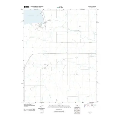
2009 Map of Langley
USGS Topo · Published 2009About this map
Langley sits at the heart of this central Kansas landscape, positioned just south of the significant water management structures of Kanopolis Lake. The 2009 survey highlights the local geography as dominated by the Smoky Hill River, which flows eastward from the Kanopolis Dam. This area reflects a classic rural grid system, with roads such as Ave V and Smoky Valley Rd connecting scattered farmsteads and agricultural plots. The map records important local historical sites, including Langley Cemetery near the settlement and Riverside Cemetery further east along the riverbanks. Several tributaries, including Sand Creek, Wolf Creek, and Wiley Creek, carve through the terrain, illustrating the drainage patterns that have historically shaped land use and property boundaries in this part of Ellsworth County.
Find a feature on this map
30 named features on this map. Tap any name to fly to it.
Don’t see what you’re looking for? This feature index may not catch every label — zoom into the map to look around manually.
Map Details
Editions of this 2009 Langley Map
This is the sole edition of this map. No revisions or reprints were ever made.
Other maps of this area

1891 · Hutchinson
USGS Topo · 1:125,000

1892 · Salina
USGS Topo · 1:125,000

1893 · Hutchinson
USGS Topo · 1:125,000

1894 · Ellsworth
USGS Topo · 1:125,000

1894 · Lyons
USGS Topo · 1:125,000

1942 · Salina
USGS Topo · 1:125,000

1955 · Falun
USGS Topo · 1:24,000

1955 · Great Bend
USGS Topo · 1:250,000

1955 · Hutchinson
USGS Topo · 1:250,000

1957 · Great Bend
USGS Topo · 1:250,000