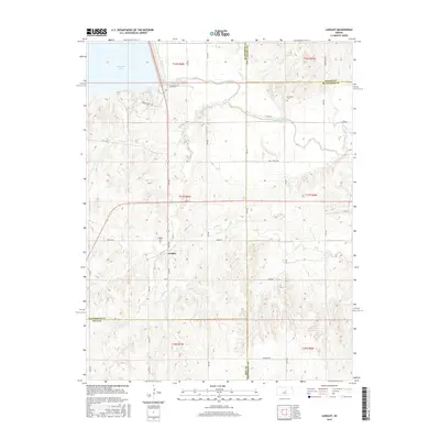
2015 Map of Langley
USGS Topo · Published 2015About this map
Langley stands at the center of this rural Kansas landscape, where the prairie meets the engineered waters of the north. The settlement is flanked by Langley Cem and lies just south of the sprawling Kanopolis Lake, which dominates the northwestern quadrant. The natural drainage of the region is defined by the winding course of the Smoky Hill River and its tributaries, including Sand Cr and Wiley Cr. This 2015 survey reveals a terrain shaped by modern reservoir management and a grid of secondary roads such as Wells Fargo Rd and Rainbow Rd. Further south and east, the map details the intricate creek systems of Wolf Cr and Rooney Cr, illustrating the agrarian character of the borderlands where Ellsworth, Saline, McPherson, and Rice Counties converge. The presence of Riverside Cem near the river indicates the long-standing community footprint in this river valley.
Find a feature on this map
41 named features on this map. Tap any name to fly to it.
Don’t see what you’re looking for? This feature index may not catch every label — zoom into the map to look around manually.
Map Details
Editions of this 2015 Langley Map
This is the sole edition of this map. No revisions or reprints were ever made.
Other maps of this area

1891 · Hutchinson
USGS Topo · 1:125,000

1892 · Salina
USGS Topo · 1:125,000

1893 · Hutchinson
USGS Topo · 1:125,000

1894 · Ellsworth
USGS Topo · 1:125,000

1894 · Lyons
USGS Topo · 1:125,000

1942 · Salina
USGS Topo · 1:125,000

1955 · Falun
USGS Topo · 1:24,000

1955 · Great Bend
USGS Topo · 1:250,000

1955 · Hutchinson
USGS Topo · 1:250,000

1957 · Great Bend
USGS Topo · 1:250,000