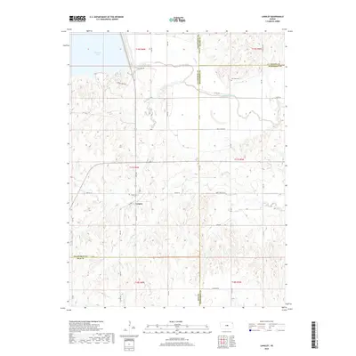
2018 Map of Langley
USGS Topo · Published 2018About this map
Langley stands as the primary settlement on this central Kansas landscape, situated at the junction of Ave WW and Ave X. The geography is defined by the significant drainage systems of the Smoky Hill River, which cuts across the northern half of the quadrangle, and the southern waters of Wolf Creek and Hoover Creek. In the northwest, the edge of Kanopolis Lake marks a modern alteration to the natural river valley, while a grid of rural roads like Wells Fargo Rd and Rainbow Rd organizes the surrounding farmland. Genealogists can locate important burial sites at Riverside Cem, positioned near the Saline and McPherson county line, and the Langley Cem just west of the town center. This area serves as a significant intersection of county boundaries, where Ellsworth, Rice, Saline, and McPherson counties all converge.
Find a feature on this map
36 named features on this map. Tap any name to fly to it.
Don’t see what you’re looking for? This feature index may not catch every label — zoom into the map to look around manually.
Map Details
Editions of this 2018 Langley Map
This is the sole edition of this map. No revisions or reprints were ever made.
Other maps of this area

1891 · Hutchinson
USGS Topo · 1:125,000

1892 · Salina
USGS Topo · 1:125,000

1893 · Hutchinson
USGS Topo · 1:125,000

1894 · Ellsworth
USGS Topo · 1:125,000

1894 · Lyons
USGS Topo · 1:125,000

1942 · Salina
USGS Topo · 1:125,000

1955 · Falun
USGS Topo · 1:24,000

1955 · Great Bend
USGS Topo · 1:250,000

1955 · Hutchinson
USGS Topo · 1:250,000

1957 · Great Bend
USGS Topo · 1:250,000