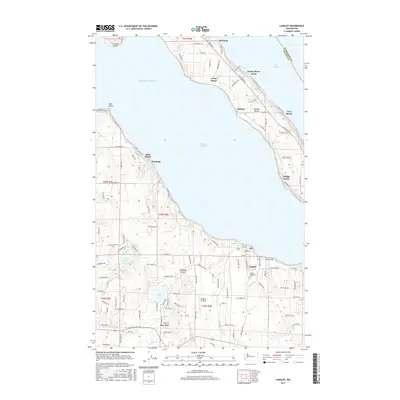
2017 Map of Langley
USGS Topo · Published 2017About this map
Saratoga Passage divides the coastline of Whidbey Island and Camano Island in this coastal Washington landscape. The shoreline is densely marked by waterfront settlements and beach communities, from the residential grids of Langley to smaller landings like Mabana, Saratoga, and Bells Beach. The interior of Whidbey Island reveals a mix of freshwater resources and local infrastructure, including Lake Goss, Lone Lake, and the Whidbey Air Park. Aviation and maritime interests meet here, with the Langley Woodman Cem serving as a primary historical waypoint for genealogists. The map details a complex network of local roads such as S Camano Dr and Lone Lake Rd that connect these island communities across the waters of Puget Sound and Port Susan.
Find a feature on this map
118 named features on this map. Tap any name to fly to it.
Don’t see what you’re looking for? This feature index may not catch every label — zoom into the map to look around manually.
Map Details
Editions of this 2017 Langley Map
This is the sole edition of this map. No revisions or reprints were ever made.
Other maps of this area

1895 · Snohomish
USGS Topo · 1:125,000

1897 · Seattle
USGS Topo · 1:125,000

1911 · Mount Vernon
USGS Topo · 1:125,000

1937 · Port Gamble
USGS Topo · 1:62,500

1939 · Coupeville
USGS Topo · 1:62,500

1940 · Port Gamble
USGS Topo · 1:62,500

1942 · Edmonds
USGS Topo · 1:62,500

1943 · Stanwood
USGS Topo · 1:62,500

1953 · Hansville
USGS Topo · 1:24,000

1953 · Freeland
USGS Topo · 1:24,000