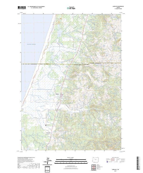
2023 Map of Langlois
USGS Topo · Published 2023About this map
Langlois and the small settlement of Denmark sit along the coastal terrace of Curry County, where the landscape transitions from the Pacific shoreline to the rising timbered peaks of the Oregon Coast Range. This modern survey illustrates the unique drainage patterns of the area, most notably the New River, which flows parallel to the Pacific Ocean behind a narrow beach strip for several miles. The coastal plain is punctuated by several significant water bodies, including Croft Lake, Muddy Lake, and New Lake, which lie just inland from the Oregon Islands Wilderness.
Find a feature on this map
59 named features on this map. Tap any name to fly to it.
Don’t see what you’re looking for? This feature index may not catch every label — zoom into the map to look around manually.
Map Details
Editions of this 2023 Langlois Map
This is the sole edition of this map. No revisions or reprints were ever made.
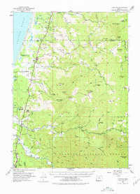
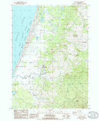
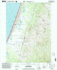
Historical Maps of Denmark Through Time
4 maps found