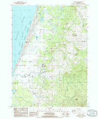
1986 Map of Langlois
USGS Topo · Published 1986About this map
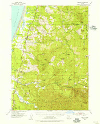
The coastal landscapes of Langlois and Denmark are defined by a complex network of waterways and agricultural bogs along the Pacific. This mid-1980s provisional survey illustrates the unique transition from the Pacific Ocean to the inland dairy and cranberry lands, separated by the longitudinal flow of the New River. Specialized land use is evident in the numerous Cranberry Bogs and Storage Bins clustered near Floras Creek. The rugged terrain to the east is marked by prominent elevations like Morton Butte and Woodens Butte, providing a stark contrast to the low-lying marshes of the Oregon Islands National Wildlife Refuge Wilderness. Genealogists and local historians can pinpoint family-connected sites such as the Denmark Cem and the small residential cluster at Bethel, while the presence of several borrow pits and a gravel pit suggests the infrastructure needs of this rural Curry County corridor during the era.
Find a feature on this map
41 named features on this map. Tap any name to fly to it.
Don’t see what you’re looking for? This feature index may not catch every label — zoom into the map to look around manually.
Map Details
Editions of this 1986 Langlois Map
This is the sole edition of this map. No revisions or reprints were ever made.
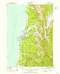
Other maps of this area

1896 · Coos Bay
USGS Topo · 1:125,000

1898 · Coos Bay
USGS Topo · 1:125,000

1899 · Port Orford
USGS Topo · 1:125,000

1900 · Coos Bay
USGS Topo · 1:125,000

1903 · Port Orford
USGS Topo · 1:125,000
1943 · Bandon
USGS Topo · 1:62,500
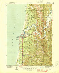
1944 · Bandon
USGS Topo · 1:62,500

1954 · Coos Bay
USGS Topo · 1:250,000
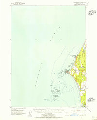
1954 · Cape Blanco
USGS Topo · 1:62,500
1954 · Langlois
USGS Topo · 1:62,500