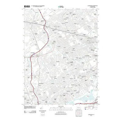
2010 Map of Lansdowne
USGS Topo · Published 2010About this map
Darby Creek and Cobbs Creek carve through this densely developed landscape west of Philadelphia, anchoring a network of boroughs and townships defined by a legacy of early industry and established communities. Traces of the region's milling history are still visible through labels like Lawrence Mills, Clinton Mills, and Wallingford Mills, alongside hydraulic infrastructure such as Crum Creek Dam and Millbourne Dam. For those researching local roots or family history, the map is remarkably dense with memorial sites, including Holy Cross Cemetery, Saints Peter and Paul Cemetery, and the Friends Cemetery. Distinctive local landmarks like the Marton Homestead and the Strayer University Delaware County Campus sit among a patchwork of residential areas like Oakmont, Llanerch, and Beverly Hills, illustrating the intensive post-war suburbanization that transformed this part of Delaware County.
Find a feature on this map
184 named features on this map. Tap any name to fly to it.
Don’t see what you’re looking for? This feature index may not catch every label — zoom into the map to look around manually.
Map Details
Editions of this 2010 Lansdowne Map
This is the sole edition of this map. No revisions or reprints were ever made.
Other maps of this area

1891 · Philadelphia
USGS Topo · 1:62,500

1893 · Germantown
USGS Topo · 1:62,500

1894 · Chester
USGS Topo · 1:62,500

1894 · Philadelphia
USGS Topo · 1:62,500

1894 · Norristown
USGS Topo · 1:62,500

1894 · Germantown
USGS Topo · 1:62,500

1895 · Norristown
USGS Topo · 1:62,500

1896 · Germantown
USGS Topo · 1:62,500

1896 · Philadelphia
USGS Topo · 1:62,500

1896 · Norristown
USGS Topo · 1:62,500